

Posts with tag 'Places to See in Central Oregon'
Subscribe and receive email notifications of new blog posts.
 RSS Feed
29
Crater Rim Trail at Newberry National Volcanic Monument Worth the Trip
Crater Rim Trail Lightly Traveled
Newberry Crater, including Paulina Peak and Paulina Falls, are often our go-to hikes when the weather doesn't cooperate in exploring the Cascades. At a lower elevation, we can often hike this area well into early winter when snow stops our adventures in the higher mountain regions. And its location, between Bend and La Pine, is an easy drive from home.
Last Saturday, we ventured into Newberry Crater to avoid the choking smoke much of Central Oregon has been experiencing from the Bedrock fire and now Lookout and Petes Lake fires as well. We were fortunate that the air stayed relatively clear during our day there and we could enjoy a great hike.
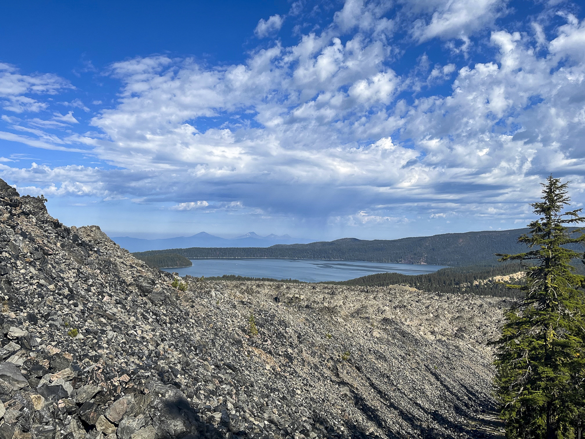
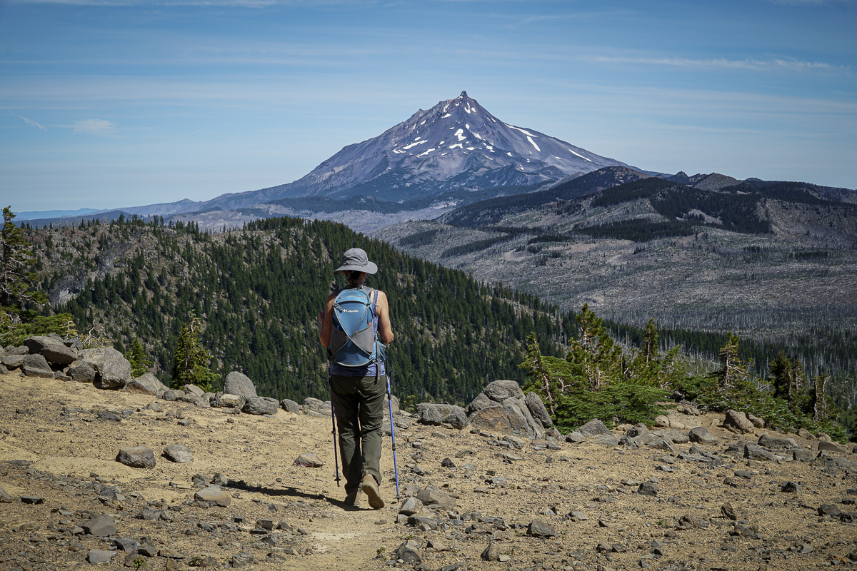
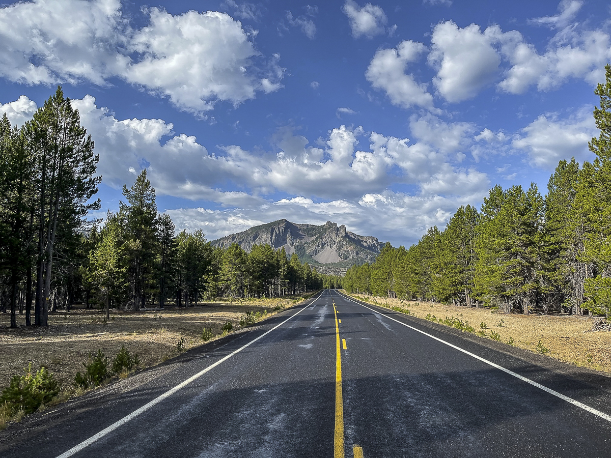 We found a hike we had never done before last Saturday. All Trails named it "Lost Lake to Crater Rim Trail" and it was a loop. The suggestion was to park at the Obsidian Flow parking lot, but we drove further down the road to an access point off the main road about a mile past.
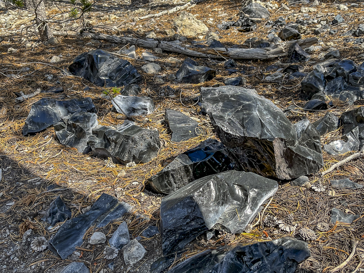
Our initial hike was through a lodgepole pine forest, but as we got further away from the road, we began to gain elevation and the trail got closer to the obsidian flow. We saw larger obsidian stones on each side of the trail as the hike got gradually steeper.
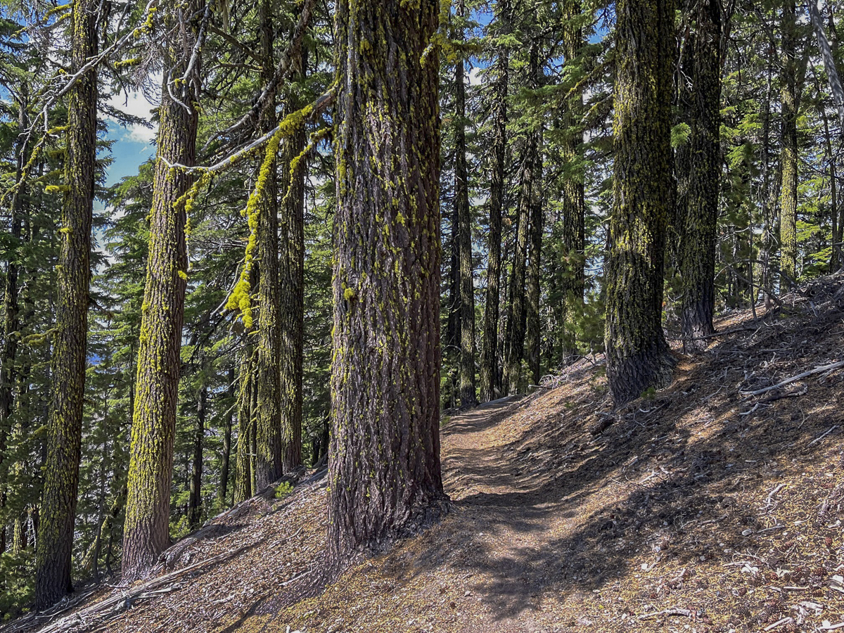
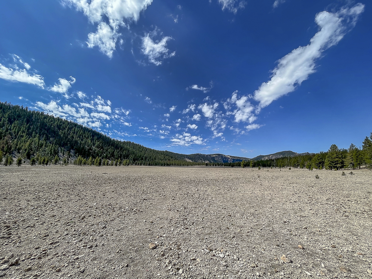
Eventually we reached the Crater Rim Trail. This trail circles Newberry Crater fully and is over 20 miles in length. We didn't want to take this hike today, but rather followed the route we downloaded. This involved a section of Crater Rim, and then a loop which dropped into a canyon that came up by Pumice Flat and rejoined our original trail. This seemed a bit short for us, so we went back up the loop and then hiked toward Paulina Peak, not fully reaching it but found a terrific lunch spot to enjoy the views of Paulina Lake. We then returned back the way we came. The entire hike was just over 13 miles with 2350 feet of elevation gain. We only saw 4 people during the entire hike - all of them riding mountain bikes.
 |
 |
 |
 |
16
Three Fingered Jack Hike From Jack Lake Trailhead a Great Mid Summer Trek
We hike Three Fingered Jack yearly and always enjoy our experience. Our 2023 hike was no exception and the air was clear, a challenge this summer with the smoke from the Bedrock fire near Eugene coming and going for weeks.
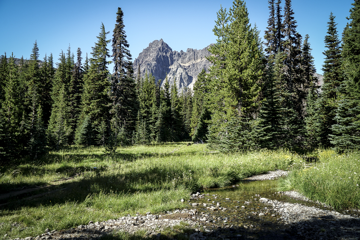
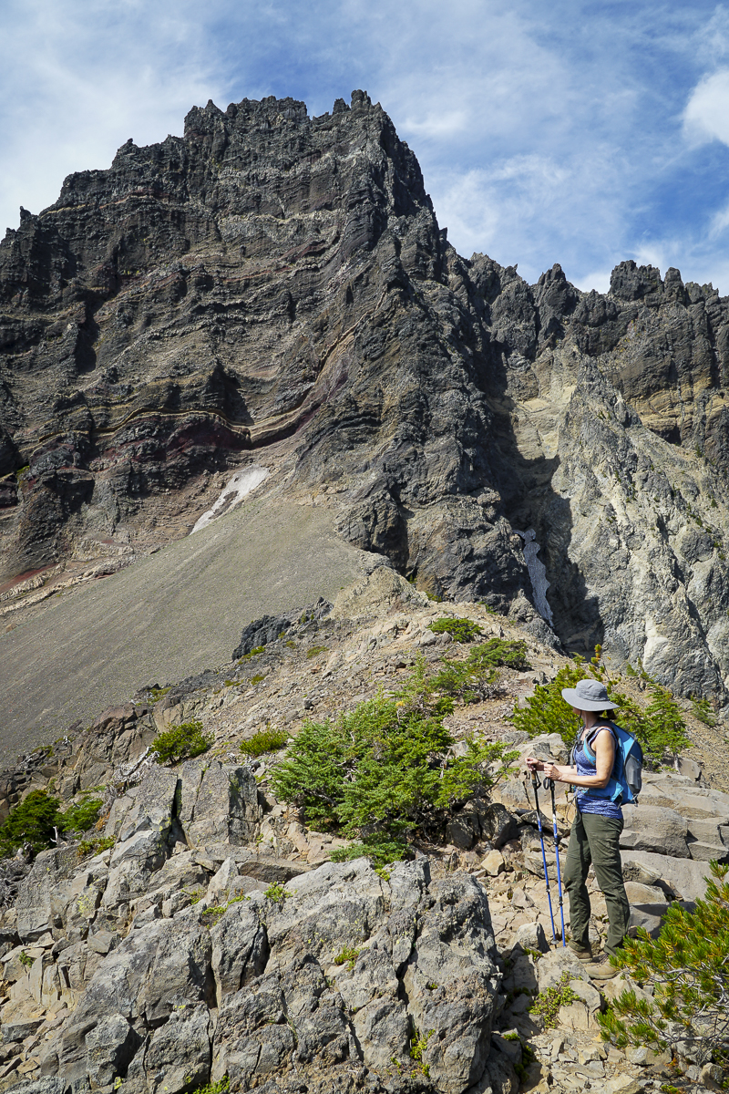
The Canyon Meadow/Three Fingered Jack hike is one of our less strenuous summer hikes, the entire route taking less than 8 miles with roughly 1700 feet of elevation gain. Traveling through the forest recovering from the 2003 B&B fire, it is nice to see the growth of new vegetation and young trees, and it was easy to sample huckleberries growing along the path. Once you enter unburned forest, it isn't far until hikers reach Canyon Meadow with its green grass, wildflowers, and views of Three Fingered Jack. The "unmaintained" spur path to the mountain had a number of fallen trees to traverse, but past that it was easy to reach the base of the moraine which holds the blue glacial lake.
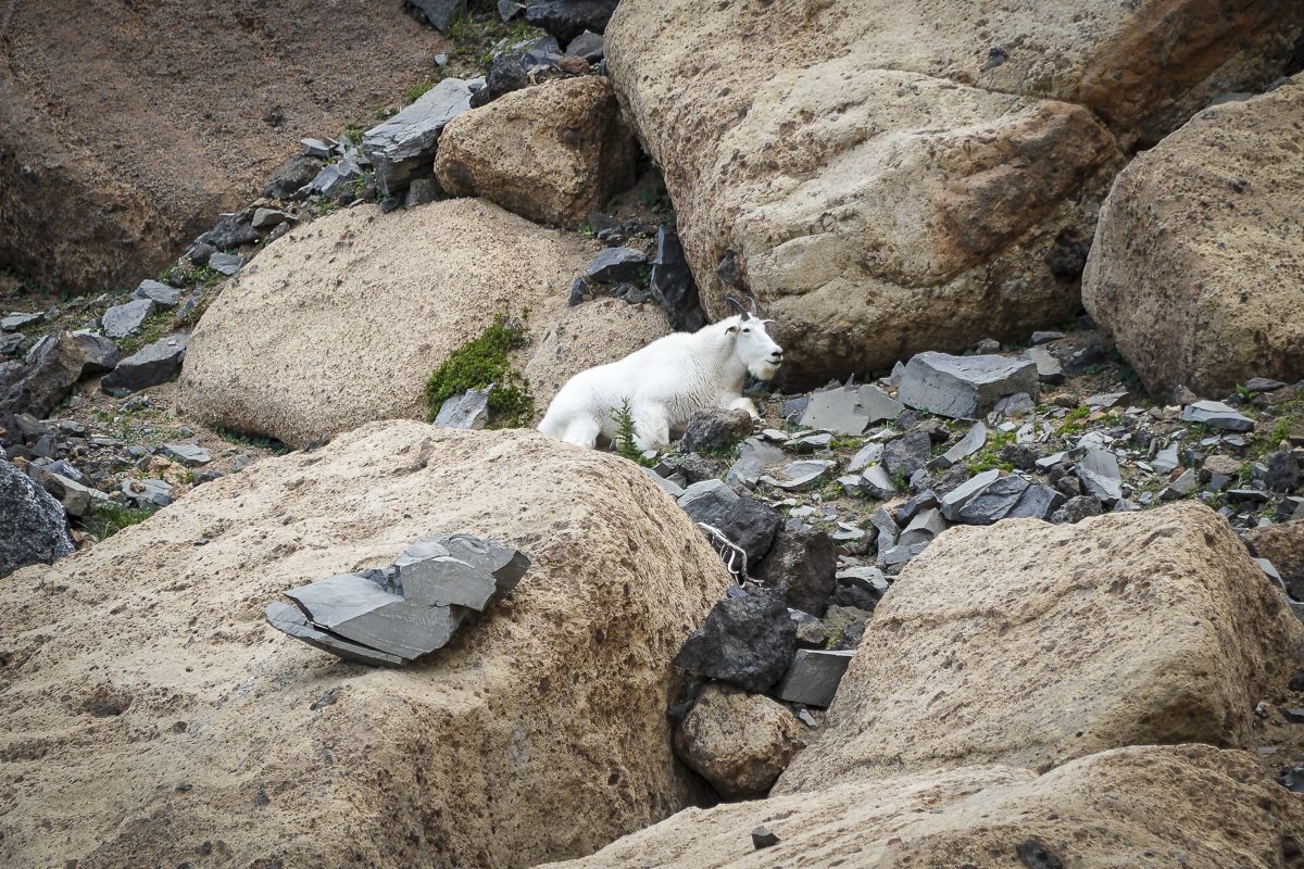
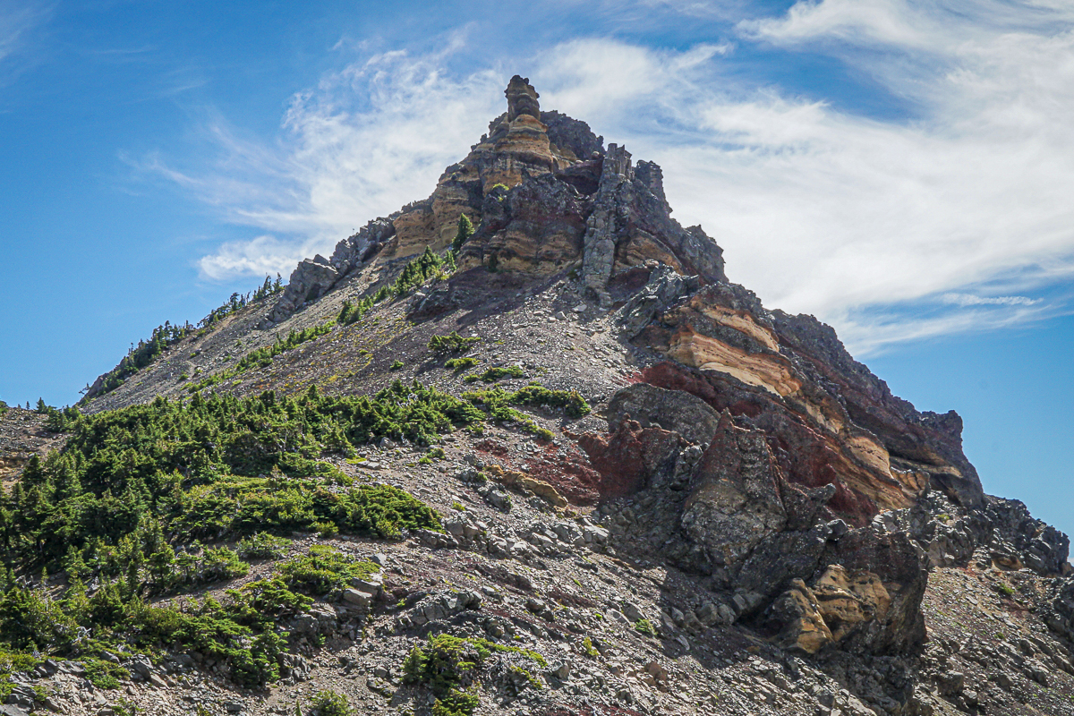
It is harder to scramble up the loose rock of the moraine (going down you have to be careful), but we always do this and reach the saddle between Three Fingered Jack and a nearby peak which we have nicknamed "Dragon Mountain". From there, stunning views of the Three Sisters, Broken Top and Mt Bachelor can be seen. Looking the other way, views of Mt Jefferson can't be missed. During this trip, we also saw a nearby mountain goat; these goats were reintroduced to the Mt. Jefferson Wilderness around Three Fingered Jack in 2010 and have grown in number.
 |
 |
 |
 |
9
Bend Premier Real Estate | August 2023 Newsletter
What's in the August 2023 Bend Premier Real Estate Newsletter?
- Bend Home Sales Average Over $1,000,000 in July
- Mt. Hood's Clear Lake Hike Worth the Trip
- Four Ways You Can Use Your Home's Equity
- There's Only Half the Inventory of a Normal Market
- Housing Market Forecast
4
Mt. Hood's Clear Lake Hike Worth the Trip
Mt Hood's Clear Lake a Popular Destination
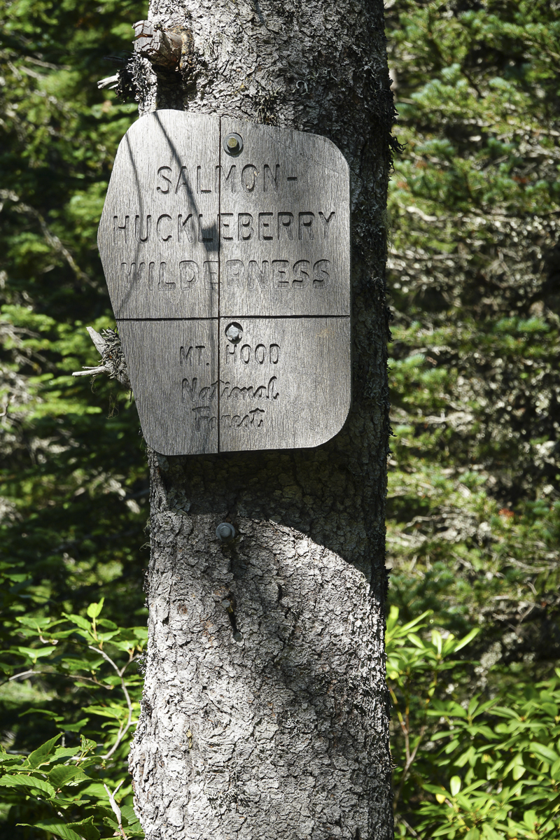
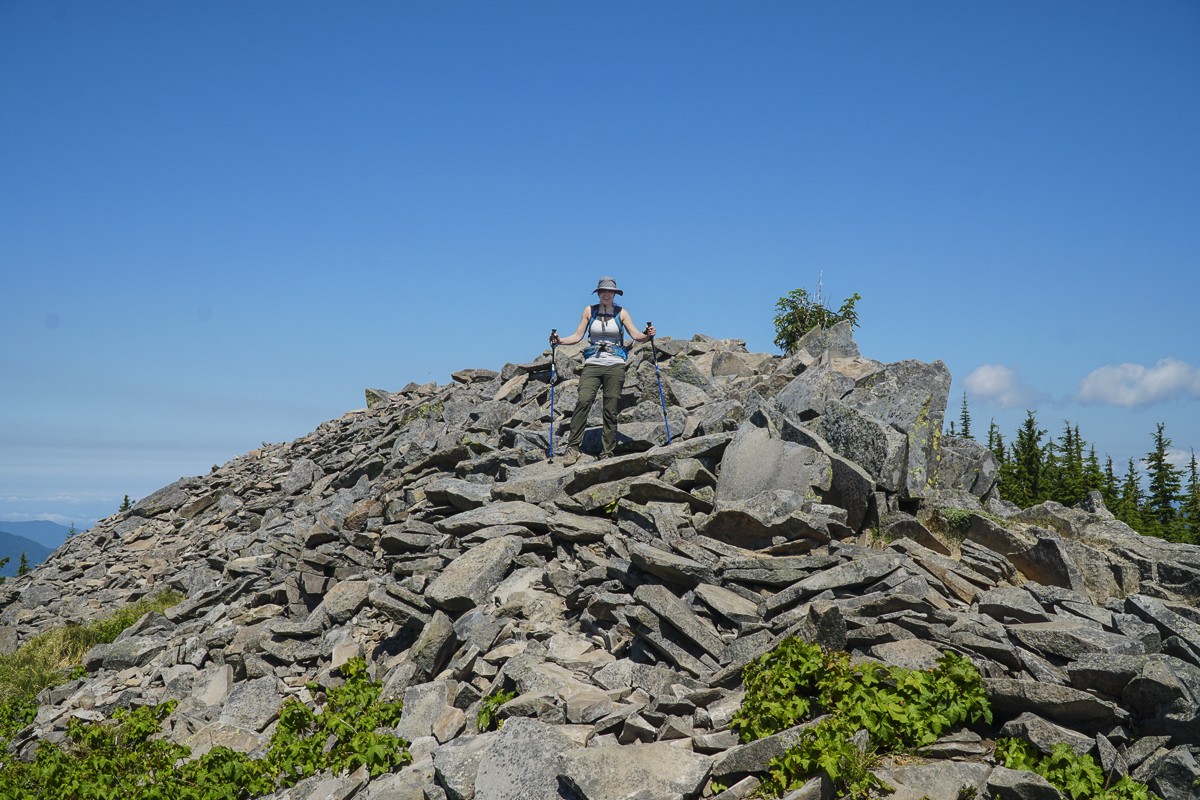
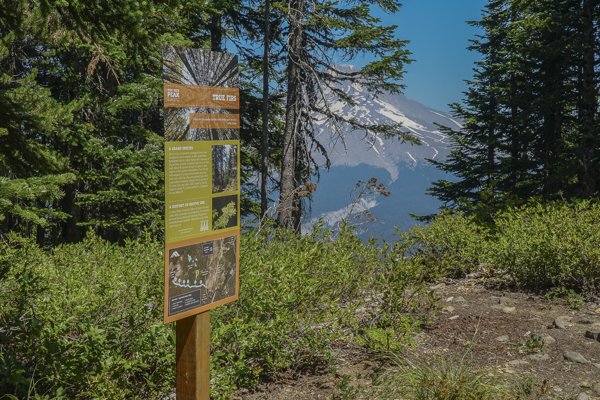
With the recent heavy smoke Central Oregon has been experiencing from the Bedrock Fire, we expanded our hiking locations to include the Mt. Hood area. Last Saturday we enjoyed the hike to Clear Lake, a popular hike located just off Hwy 26 by Skibowl in the Mt Hood National Forest. We started our hike just after 9:00 am after our two hour drive from Bend, and found the parking lot practically full. The hike to Clear Lake was well marked and typically is an easy to moderate in and out loop trail around the lake with roughly 300 feet of elevation gain. 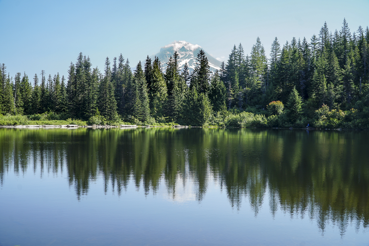 However, past the lake, which has lovely views of Mt. Hood on a clear day, there is an option to hike up Tom, Dick and Harry Mountain in the Salmon - Huckleberry Wilderness, a trip that provides for over 1700 feet of elevation gain and lengthens the total hike to over 8 miles.
Upon reaching the rock filled overlook, we continued on another 1/2 mile to the actual summit on Tom Dick Peak, which we discovered is part of SkiBowl recreation area, clearly not part of the Salmon-Huckleberry Wilderness. Our GPS showed an option to hike down through the ski area, which we did. This involved traversing several diamond runs and connecting with the unused mountain bike trail. Our hike down to the Skibowl buildings by the parking lot was extremely steep and what took over 4.5 miles to gain in elevation we lost in just over 1 mile. We do not recommend this route for most people. However, it was a beautiful day with wonderful views of Mt Hood and a pleasure to be out of smokey Central Oregon.
 |
|
27
Balloons Over Bend This Weekend!
Balloons Over Bend Starts Friday
There is a fascination with watching colorful hot air balloons rising at sunrise in the Central Oregon sky with the backdrop of the Cascades and the high desert landscape. Starting this Friday, the annual Balloons Over Bend festival will run through Sunday offering daily sunrise launchings of the hot air balloons, Night Glow Friday evening in Bend and Saturday evening in Redmond, plus many fun activities for the whole family during the day. The planned schedule is as follows:
Friday July 28, 2023
- Balloon launches at Sunrise at RE Jewell Elementary School
- Balloon blast kids race at COCC
- Bend Night Glow at COCC
Saturday July 29, 2023
- Balloon launches at Sunrise at RE Jewell Elementary School
- Redmond Night Glow and Brewfest at the...
Privacy Policy / DMCA Notice / ADA Accessibility